26 Feb, 2012
Snaps
 |
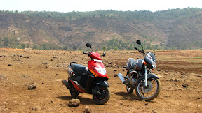
| Lavasa Bike Ride Feb 2012 |
Travelling Directions
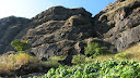
A 1600 k.m. journey in the southern Konkan region of Malvan. Laced with the beach trips of Tarkarli, Devbag. With snorkeling at the base of the Sindhudurg fort and then drying up the clothes in the peripheral tour of the fort itself.
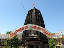
Vijaydurg’s 80km trip from Tarkarli through the temples of Kunkeshwar adding more to the “Jai Maharashtra” soul. A visit to a local traditional house in Achara (20 km from Malvan) on the way back like garnishing on the tasty trip.
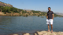
Goa’s beaches beckoning just 100 kms down south of Malvan. The fort trips continued with Chapora fort overlooking the Vagator beach. Calangute beach however disappointing with its overcrowded sands.
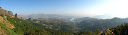
The south of Goa had more to offer with its Agonda fort or Cabo de Rama fort with lovely backdrop of hills’ cliff falling straight into the Arabian Sea. The Agonda beach with its tranquil sunny warmth and egg-laying turtle sands like an icing on the desert.
Mumbai to Malvan via NH 17, then to Goa using Coastal highway or Mahasagari Marg.
View Larger Map
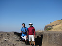
Tour of Campo De Rama fort and Agonda beach in Canacona, Goa
View Larger Map
 |
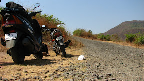
| Sindhudurg, Goa, Dec 2011 |
Sep 4, 2011
Barvi Dam! Took a right at Murbad (NH 222), enjoyed the overflow @ Barvi Dam, then moved along the water reservoir to get back to Murbad. Went on straight forward towards Shahpur (NH3). En-route took a de-tour to a Asnoli-Jamba Dam, which was just lovely quiet place, yet again overflowing.
The rains, the sun and the bad roads were not very greatful to my bike. Poor her, suffering from punctured muffler joint @ the engine.
Aug 21, 2011. Had been to this awesome Ride to Vihigaon Waterfalls, then moving onwards towards Jawhar and Dabhosa Waterfalls, and back! 366km of bum-breaking journey 😀
Note:
Google map doesn’t show the road from Kasara to Jawhar (Hence the map shows a route via Igatpuri, Ghoti.
Just zoom in.. and u’ll see a road (The road is kickass for bikers ! ;))
Bliss = Hard Rains + Empty Highway + 70kmph with my GF + Drenched Me !
July 3, 2011
May 15, 2011
Another weekend, another shot @ biking. This time it was Thokarwadi Dam, Kamshet, Taluka Maval, District Pune.
The long winding road after the left @ Kanhe village just 7km ahead of Kamshet took us through a long tar ribbon bordering the parched dams of Nethersule and Thokerwadi
Thokarwadi Dam Bike Ride
Last Sunday, 27th Mar 2011. Two hell-boys, me and Manas had been to this Slope on the hill near Kamshet. So what’s different – except that we trekked the mount with our bikes.
Get to Kamshet, NH4 (NOT MUMBAI-PUNE EXPRESSWAY)
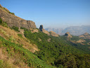
I love my state, Maharashtra. Recently had been to this lovely little trek (only 2 hours for climbing) of Ratangad, BUT … BUT a very long way to the base village, Ratanwadi.
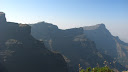
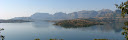
The path to Ratangad was showered with the lovely hills, mountains en-route through one of the loveliest lakes in India, The Bhandardara lake (Wilson Dam). The road winds through the Igatpuri range, first roaming around some of the virgin hills and then through the emperors, starting with Kalsubai. The pinnacle with a small hump at the very top, a very distinguishable feature, keeps overlooking your ride/drive right till you climb Ratangad.
The base of the mountain, Ratanwadi is a small village of not more than 200 dwellers. It has an ancient temple, Amruteshwar along the banks of the Bhandardara lake. The village itself is on the opposite end of the Dam, hence about 1/2 hrs boat ride from the dam or 20km of ride from the Dam. The lake at the village provides with perennial water supply and free natural swimming pool unmatched in its beauty, surrounded with peaks of Kalsubai, Ratangad.
From the top of Ratangad, one can view the adjacent magnificence of the Sahyadri Range, next to Kalsubai are Alang, Madan, Kulang mountains (one of the difficult climbing routes – for guys like us). On the otherside is the intimidating “Ajoba”